The sharpest line on this morning’s forecast is not “unsettled weather.”
At 05:00 SAST the South African Weather Service issued its regional product for Saturday 5 September. It holds an Orange Level 5 warning for severe thunderstorms over the central parts of the Northern Cape. SAWS ties that level to flooding of susceptible settlements and roads, strong gusty wind and hail that can damage structures and bring down trees, and municipal service outages from excessive lightning.
That is the definition of the colour. Not a headline flourish.
A Yellow Level 4 warning covers the central and eastern Northern Cape and the extreme western parts of North West — the same family of hazards at a slightly lower impact rating. A Yellow Level 2 storm warning sits over the Free State and most of North West. Separate Yellow Level 2 warnings flag damaging wind and waves from Richards Bay to Kosi Bay, and damaging winds from Cape Town to Cape Agulhas.
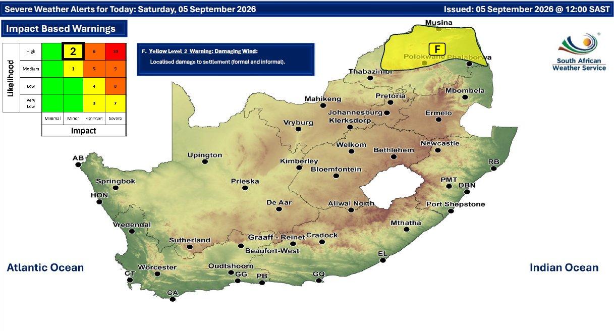
Gauteng is not on Level 5. It is still in the system: cloudy and cool, scattered showers and thundershowers, with a rain chance around 60% in places and a risk of local strong wind, hail and lightning. That matters because stadium traffic and road closures are already advertised for Saturday in Johannesburg. Storm cells and a packed precinct do not need each other to become a mess. This is not a match preview. It is a roads-and-outages note.
The forecast is scheduled to update at 16:00 SAST. Until then, treat the 05:00 product as the live brief. Do not wait for a viral hail video to decide whether zinc roofs and low drifts in the Northern Cape needed attention this morning.
Rainfall coverage in the Northern Cape core is described as widespread to scattered, with a high chance of rain in the central and eastern parts. Western areas are cooler and less uniform. Morning fog patches are noted in places in the south of the province. None of that replaces the impact wording attached to Level 5.

An Orange Level 5 warning, on SAWS’s own wording this morning, is an impact warning: flood-prone settlements and roads, damaging hail and wind, falling trees, lightning-driven municipal outages. Lower yellow levels mean the same hazards at smaller scale. It is not a guarantee that every town on the map will flood. It is a statement that the ingredients are in place in the named belts.
If you are in the central Northern Cape, treat low watercourses, informal stands and tree-lined roads as closed-minded until the 16:00 update. If you are in western North West or the Free State, expect hit-and-miss cells, not a uniform soaking. If you are driving in Gauteng, build extra time around wet tar and any stadium diversions. If you work boats or ports on the two named coastal stretches, the warning is for navigation and harbour disruption, not for a picnic.
* Does SAWS hold, upgrade or drop Level 5 at 16:00?
* Which Northern Cape towns report flooding or hail first?
* Do municipalities open points that actually take people, or only issue WhatsApp graphics?
* Does Gauteng’s match-day traffic plan survive the first decent cell?